Modernising Streetlight Management with STOP GIS
Our Network Electrical Servicing (NES) Team has developed the Streetlight Turn On Point (STOP) GIS system, a significant step forward in how streetlight circuits are managed, maintained and understood across the region.
By combining technical expertise with practical, field-focused design, NES has delivered a system that improves operational efficiency, enhances safety for crews, and supports the delivery of reliable streetlighting services for local communities.
Client: Regional Councils (SDC, ICC, CDC)
Service: GIS Development & Asset Management Support

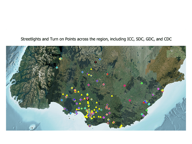

Data sourced from the LINZ Data Service and licensed by Invercargill City Council for re-use under the Creative Commons Attribution 4.0 International
Project Overview
Traditionally, streetlight circuit information was stored in paper-based maps, making it time-consuming and challenging for field crews to quickly locate critical infrastructure. NES identified an opportunity to modernise this process and improve both safety and efficiency in the field.
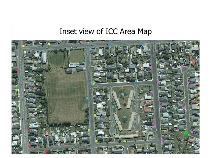
The STOP GIS system converts legacy paper records into a detailed, easy-to-use GIS platform. Field teams can now clearly view streetlight circuits, identify circuit turn-on points for isolation, and see which transformers supply individual circuits across the SDC, ICC and CDC networks. This level of visibility supports faster fault response, safer isolation procedures, and more informed decision-making on site.
Designed to integrate seamlessly with existing asset management systems, including AWM (RAMM), the STOP GIS system ensures accurate data sharing across platforms while supporting ENO compliance requirements. The result is a smarter, more connected approach to streetlight asset management.